Top Ten Flat-Earth Claims & Easy Rebuttals
Quick experiments and observations you can perform yourself to show why the globe wins every time.
1. “Water always finds its level, so oceans can’t curve.”

“Level” means perpendicular to gravity, not perfectly flat; Earth’s vast radius makes the curvature imperceptible over short distances. A simple laser across a lake shows the surface dropping away by about 8 inches per mile².
Purpose: To critique the spherical model by misapplying the concept of “level” in geodesy.
Significance: Underscores the necessity of understanding geodetic leveling and the scale of Earth’s curvature in surveying.
2. “The horizon is always at eye level and looks flat.”

At cruising altitude (~10 km) the true horizon sits ~3° below eye level. A simple inclinometer or sextant confirms this dip as you ascend. Pilot recordings and balloon footage clearly show a convex horizon that sinks gradually with altitude.
Purpose: To assert a flat horizon based on unaided vision and misunderstanding of perspective.
Significance: Emphasizes the value of precise angular measurement in validating Earth’s curvature.
3. “You can see the Chicago skyline across Lake Michigan, so the lake is flat.”

That famous photograph captures a superior mirage: a temperature inversion refracts light upward, revealing buildings hidden below the geometric horizon. On days without inversion, only the uppermost floors appear above the waterline.
Purpose: To use an optical anomaly as “proof” of flatness.
Significance: Highlights atmospheric refraction’s role in long-distance sighting experiments.
4. “All globe photos are CGI—NASA is faking it.”

Independent geostationary satellites like Himawari-8 (Japan) and Meteosat (Europe) beam live full-disk images every 10 minutes. Their cloud patterns match terrestrial weather radars in real time—impossible to synchronize if doctored.
Purpose: To undermine trust in photographic evidence of Earth’s shape.
Significance: Demonstrates the cross-verification of independent satellite data worldwide.
5. “If Earth spins 1 000 mph we’d be flung off—or at least feel it.”
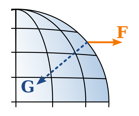
What matters is acceleration (centripetal), not speed. At the equator, centrifugal acceleration is only 0.034 m/s² (~0.3% of g). It’s akin to the sideways pull in a gentle car turn. Foucault pendulums and Coriolis-influenced weather patterns are subtle, yet undeniable, proofs of rotation.
Purpose: To misinterpret linear velocity as perceivable force without context of radial acceleration.
Significance: Underlines the difference between speed and acceleration in physics.
6. “Pilots never dip the nose; they’d fly off the globe.”
An airliner cruising at 900 km/h adjusts its pitch by less than 0.03° per second to maintain altitude, compensating for Earth’s curvature. Autopilot systems and altimeters handle these minute inputs automatically, invisible to passengers.
Purpose: To claim that pilots would visibly “tilt down” if following a spherical surface.
Significance: Shows the necessity of instrumentation and small incremental corrections in aviation.
7. “Gravity isn’t real—only density and buoyancy exist.”
Density and buoyancy describe how objects move in a fluid, but require a gravitational field to define “downward.” In a vacuum chamber, a bowling ball and feather accelerate equally at 9.8 m/s² toward Earth’s center, exactly as Newtonian gravity predicts for a spherical mass distribution.
Purpose: To reject the concept of a central gravitational force in favor of everyday fluid effects.
Significance: Reinforces gravity as a fundamental interaction validated by controlled experiments.
8. “No stellar parallax is observed; therefore Earth doesn’t orbit the Sun.”
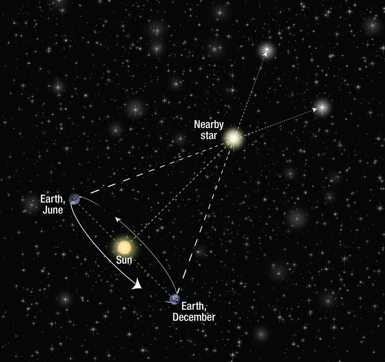
Stellar parallax was first measured in 1838 by Friedrich Bessel. Today, ESA’s Gaia mission tracks the tiny annual wobble of over two billion stars with micro-arc-second precision—measurements incompatible with a stationary flat disk.
Purpose: To deny Earth's orbital motion by ignoring historical and modern astrometric data.
Significance: Highlights the evolution of precision astronomy and its role in confirming heliocentrism.
9. “Antarctica is an ice-wall nobody crosses.”
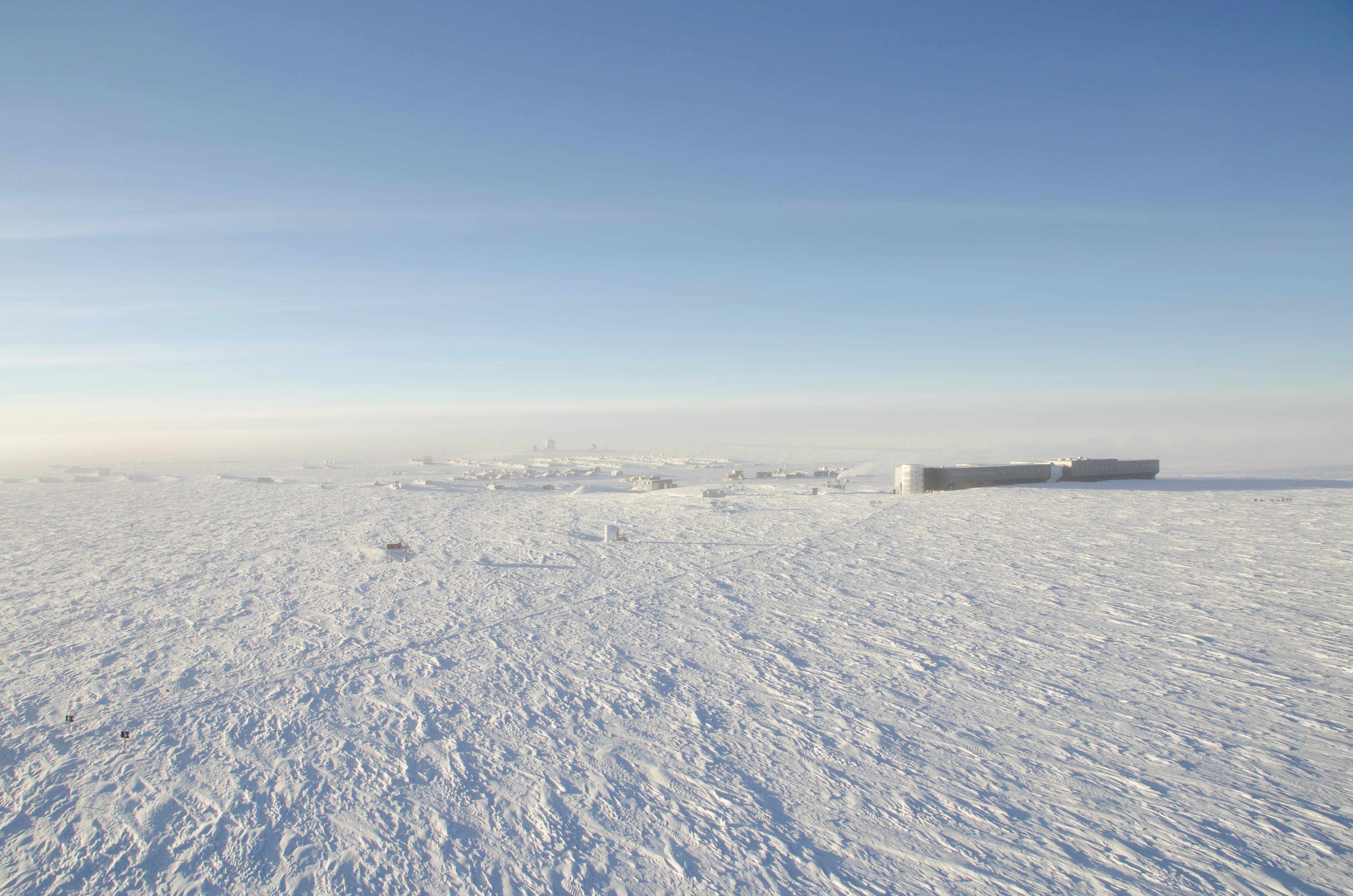
Antarctica is fully circumnavigated by research vessels and tourist ships during the austral summer. Overland traverses by snowcats, skis, and aircraft use GPS and pre-planned routes—only possible on a spherical projection.
Purpose: To romanticize a forbidding “ice wall” as evidence of a flat boundary.
Significance: Underlines the logistical and cartographic evidence supporting global circumnavigation.
10. “Gyroscopes prove Earth is stationary.”
Ring-laser gyroscopes detect Earth’s 15° per hour rotation almost immediately. These instruments form the backbone of inertial navigation in aircraft and submarines, relying on the planet’s turn to calibrate orientation.
Purpose: To claim that consistent gyroscope readings indicate a motionless base.
Significance: Demonstrates how gyroscopic technology depends on and confirms terrestrial rotation.